
BOLSOVER LOOP: FREQUENTLY ASKED QUESTIONS
- Dec 22, 2025
- 3 min read
What is the Bolsover Loop?
The Bolsover Loop is a 26‑mile circular route linking towns, villages, greenways, nature reserves and heritage sites across Bolsover District. It brings together everything from prehistoric cave art and historic mills to country parks, sculpture trails and former railway lines reclaimed as beautiful walking and cycling paths.
The route is fully waymarked in both directions, so you can start anywhere and travel clockwise or anticlockwise.
How do I navigate the route?
Navigation is supported by:
Finger post signs
Bolsover Loop roundels
New interpretation lecterns at key points
The NDNN App (North Derbyshire & North Nottinghamshire App) — includes maps, route info, and local highlights
You can also scan the QR code on Loop signage and leaflets to download the app instantly.


Where does the route start and finish?
Because it’s a loop, you can begin at any point. Popular starting locations include:
Pleasley Pit Country Park
Bolsover Castle area
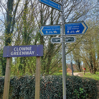
Clowne Greenway access points
Creswell and Poulter Country Park
How long does it take to complete the full 26 miles?
Approximate timings:
Walkers: 8–10 hours
Runners: 3.5–6 hours
Cyclists: 2–4 hours
Your pace, weather, and how often you stop to explore will influence your time.
Can I complete the route in shorter sections?
Yes. The Loop is divided into clear stages, and it passes through multiple villages and trail junctions.
What kind of terrain should I expect?
A varied mix of:
Greenways and former railway lines
Woodland paths
Country lanes
Open farmland
Limestone cuttings
Nature reserves and parkland
Some areas can be muddy in wet weather, so sturdy footwear is recommended.
Is the route suitable for bikes?
Most of the Loop is bike‑friendly. Gravel bikes and mountain bikes are ideal. A few short sections may require dismounting depending on conditions.
Are dogs allowed?
Yes - dogs are welcome. Please keep them under control, especially around livestock, and follow local access guidelines.

What facilities are available along the route?
Facilities vary by location, but you’ll find:
Cafés, pubs and shops in villages such as Bolsover, Clowne, Creswell and Shirebrook
Toilets at Pleasley Pit, Bolsover Castle and some local parks
Visitor centres at Pleasley Pit and Creswell Crags (if you detour)
Picnic areas at various points
Where can I park?
Parking is available at several points around the Loop, including:
Pleasley Pit Country Park
Bolsover town centre - free parking in multiple car parks
Clowne and Creswell (public car parks and on‑street options)
Poulter Country Park
Always check local restrictions and time limits.
Where can I get a leaflet or map?
You can find printed leaflets at:
Pleasley Pit Visitor Centre
Local libraries and community hubs
Bolsover Castle (visitor centre)
Selected cafés and attractions along the route
Digital versions and GPX files are available through the NDNN App
Is the route waymarked?
Yes - the entire Loop is signposted in both directions. Look out for:
Bolsover Loop roundels
Finger posts
Interpretation lecterns explaining local history and points of interest
Do I need to register or pay to use the route?
No. The Bolsover Loop is free and open to the public year‑round.
Are there any highlights I shouldn’t miss?
The Loop includes many standout locations, such as:
Pleasley Pit Country Park – nature reserve and heritage site
Rowthorne Trail – peaceful woodland and farmland views
Carr Vale & Peter Fidler Nature Reserves – top birdwatching spots
Bolsover Castle Viewpoint
Walking Together Mining Memorial
Clowne Greenway – limestone cuttings and wildlife
Creswell Model Village
Poulter Country Park – sculpture trail and meadows
Pleasley Vale – dramatic gorge and historic mills
Is the route open all year?
Yes. Seasonal conditions vary:
Winter: muddy, slippery in places
Spring/Summer: best for views and wildlife
Autumn: beautiful colours, but trails may be wet
Check the weather before setting out.


Comments